The need to protect trees remaining after the Currowan bushfire seems obvious. However for some the bushfire has given reason to cut down more trees.
On returning after the NSW lockdown to two survey sites in Conjola National Park I was dismayed at the first to find a large shelterbelt had gone and that the roadside treeline had been cut back a further ten to twenty metres from the road. This occurred some time between June 2021 and October 2021, during the lockdown period - over a year and a half after the fires!
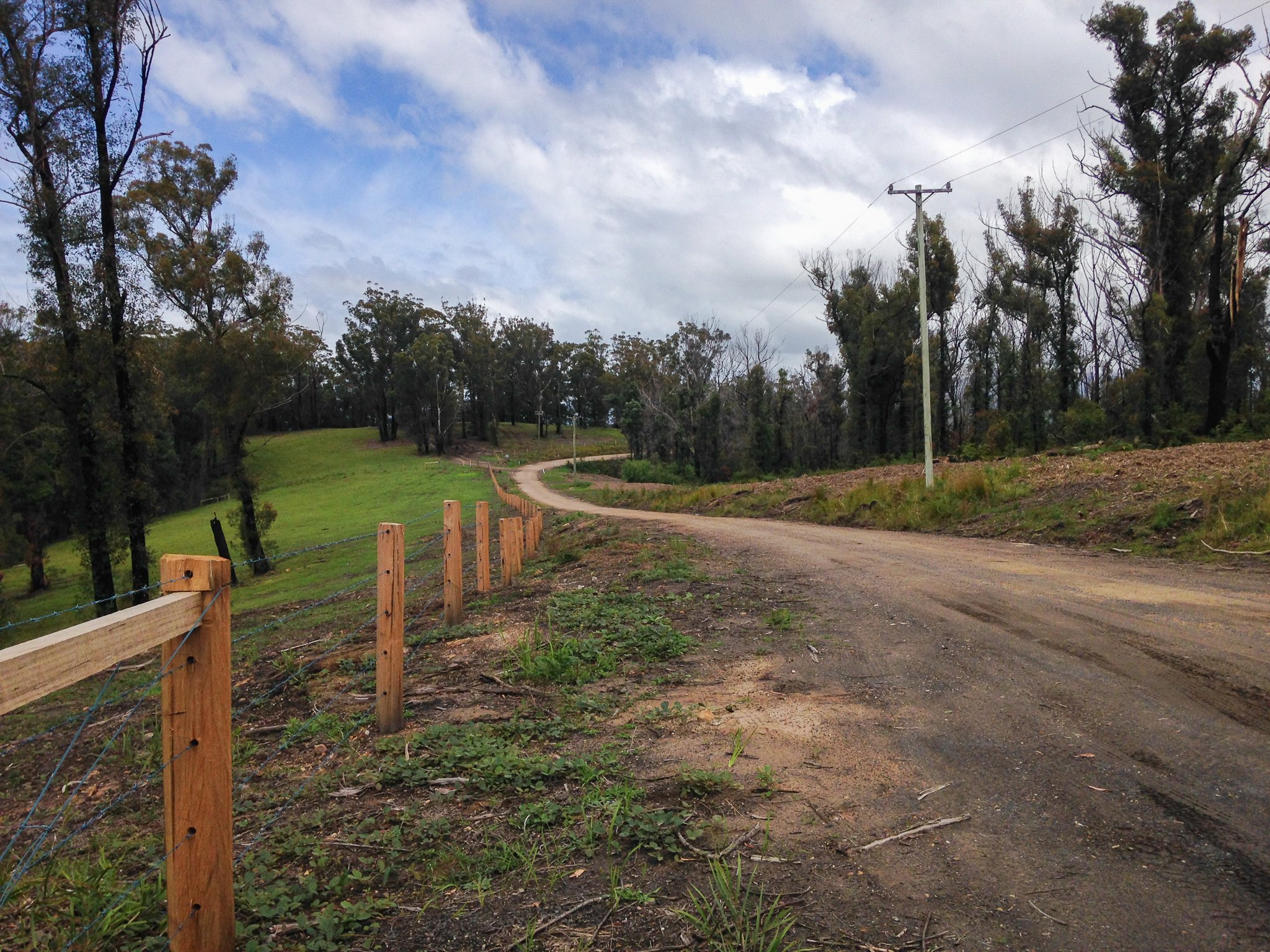
The Bendalong Mountain Road Birdata survey site extends from this point close to the Bendalong Road corner to the far corner 200 metres down the road. On the left hand side of the road a shelterbelt of mature eucalypt trees has been totally removed and replaced by the barbed-wire fence. On the right hand side of the road the treeline has been cut back ten to twenty metres from the power lines.
At the second site on nearby Nerringillah Road the trees had again been cleared a further ten to twenty metres from the road. In addition there has been extensive clearance of trees along the Bendalong road, for approximately two kilometres the bush has been cleared 10 to 20 metres back from the road.
On enquiry it seems that this clearance is legal. There are a number of regulations that might have allowed removal of these trees. Electricity companies have powerful “rights” to clear land where there are above-ground powerlines. Under the Electricity Supply Act 1995 and even the the Biodiversity Conservation Act 2016, they have an absolute power to remove trees.
Then in August this year the NSW government introduced new rules that allow landowners to clear rural land within 25 metres of their boundary with very few restrictions; the Rural Boundary Clearing Code under the Rural Fires Act 1997. If the land has not been previously protected there is little requirement to consider environmental impact and no need to offset the loss of vegetation.
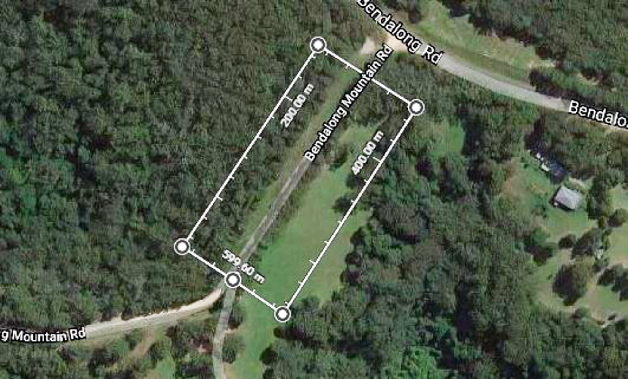
The Bendalong Mountain survey site is a standard Birdata two hectare site for conducting 20 minute surveys. This older map of the site was prepared on Google Maps. It shows the shelter belt at the road side and the bush on the left hand side, part of Conjola National Park.
The reason for this clearing is likely to be given as “ bush fire risk management” but it seems highly unlikely that these clearances would have protected anything or in any way changed the course of the devastating Currowan fire last year.
I started monitoring these survey sites after the fires, to get an idea of bird numbers in the central area of Conjola National Park. At that time the park was still closed so road-side sites were the only way you could do this.
There are not a lot of birds in this area, at least this has been the case during the surveys I have done since the fires. The most recent survey, conducted after tree removal, counted eight and seven total birds on the sites respectively in a 20 minute count. It will be difficult to see if the removal of trees has any effect on bird numbers in this small area. Nevertheless clearances like this are part of the insidious decline in habitat, responsible for the decline of bird species generally.